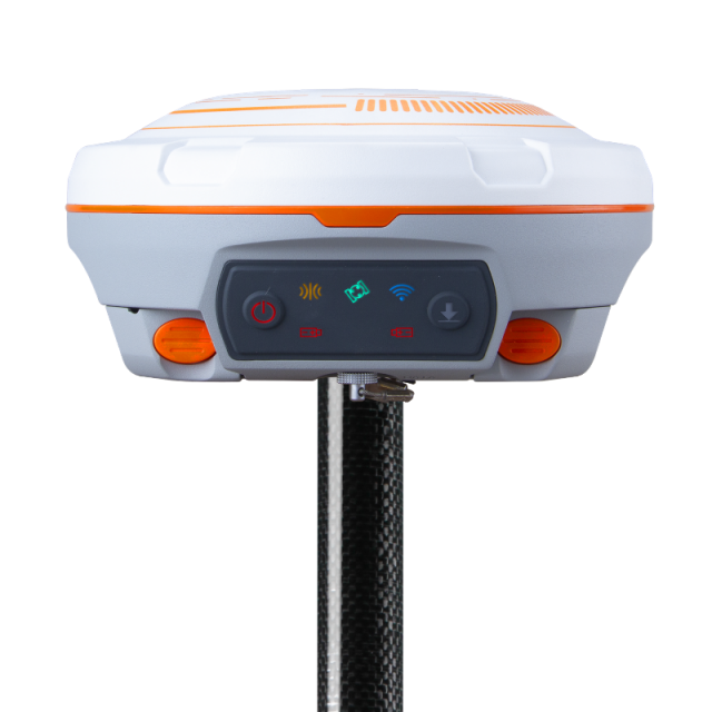
N3 IMU RTK GNSS Receiver
The N3 IMU RTK GNSS Receiver is a high-precision navigation and positioning device used in geospatial surveys and mapping. It combines Real-Time Kinematic (RTK) technology for centimeter-level accuracy and an Inertial Measurement Unit (IMU) for enhanced stability and reliability, even in challenging environments like dense forests or urban canyons. Its compact design and advanced features make it ideal for land surveying, construction, UAV mapping, and other geospatial applications.
Features:
•Enhanced UHF modem with a 15 km work range.
•Integrated IMU module for 60° tilt surveys with 2 cm accuracy.
•Low power consumption (1.7W) for extended working hours.
•Rugged and waterproof housing (IP67-rated) for challenging environments.
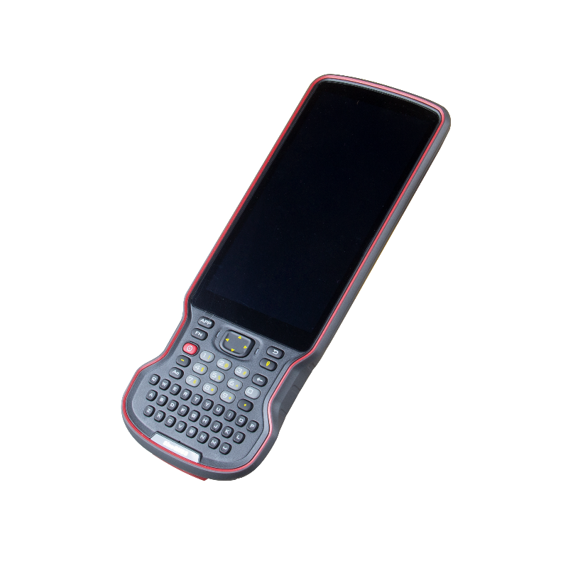
R60 Data Collector
The R60 Data Collector is a rugged, handheld device designed for field data collection in geospatial and surveying applications. It features a user-friendly interface, high-performance processing, and compatibility with GNSS receivers and surveying equipment. With durable construction, long battery life, and advanced connectivity options, the R60 ensures efficient and accurate data recording in challenging environments.
Features:
•5.5″ sunlight-readable 1080p HD display.
•Ergonomic design with advanced NFC pairing for seamless connectivity.
•9000mAh battery for over 30+ hours of operation.
•Physical full QWERTY keyboard for enhanced efficiency.
•Rugged build: Survives 1.6m drops and includes anti-static design.
.


DJI Phantom 4 Pro V2.0 Drone
The DJI Phantom 4 Pro V2.0 is a high-performance drone designed for aerial photography, mapping, and surveying. It features a 20 MP camera with a 1-inch CMOS sensor for stunning image quality and 4K video, along with advanced obstacle avoidance for safer flights. With a range of intelligent flight modes and precise GPS, it is ideal for professionals in industries like geospatial surveying, construction, and agriculture.
Features:
•1-inch 20 MP CMOS sensor for stunning aerial imagery and detailed mapping.
•Mechanical shutter to eliminate rolling distortion.
•Intelligent flight modes for automated and precise data capture.
•30-minute flight time with a range of up to 7 km.
•Obstacle sensing in five directions for safe operations.
Ideal for: Aerial mapping, inspections, and photogrammetry projects.
